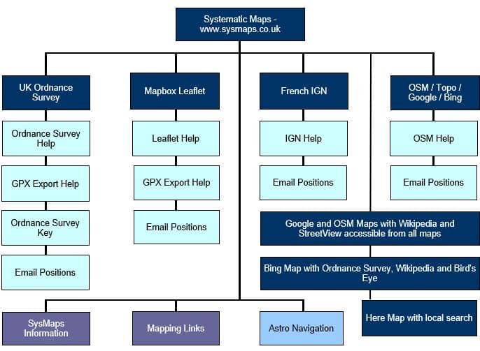
Framework
Explanation of the main options and links to each of the maps
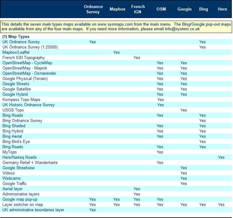
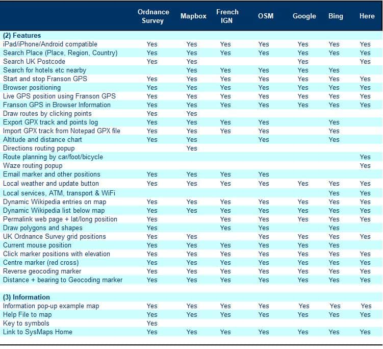
Specification
Specification and features on each of the maps - UK Ordnance Survey, Mapbox, French IGN, German Topo/OpenStreetMap, Google, Bing and Navteq.
Download the specification ![]() as a pdf file or email if you need any assistance.
as a pdf file or email if you need any assistance.
© 2025 Systematic Maps : Developed by Systematic :
Email: [email protected]


