Systematic Navigation
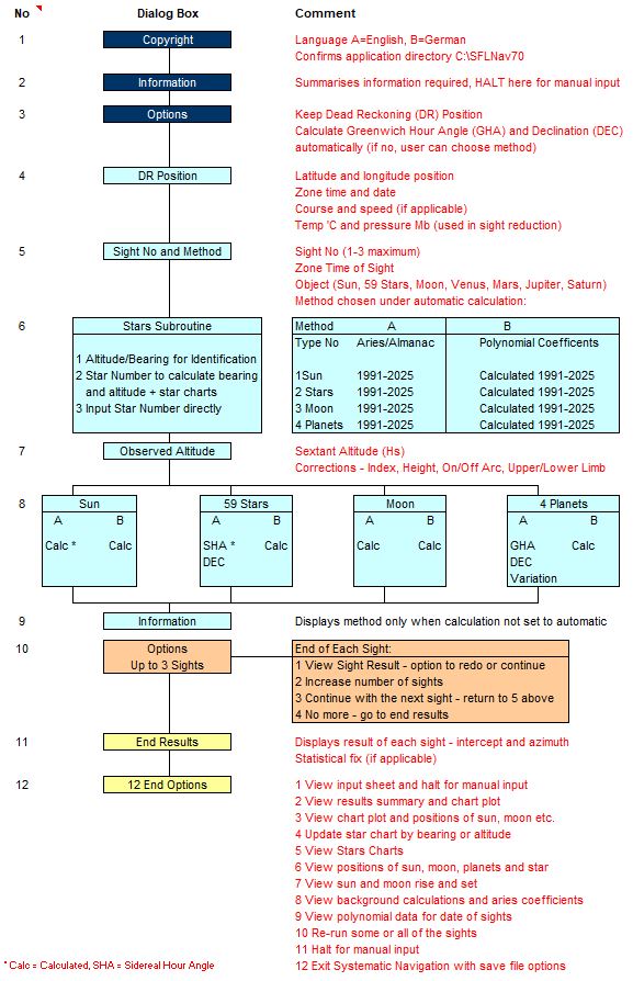
Systematic Navigation solves all the problems of calculating hour angles, declination and sight reduction and then plots sight lines and statistical fixes for up to three sights. It is totally automated and removes the need for a pocket calculator, almanac or sight tables and provides:
- Position fixes from two or three sextant sights without an almanac
- Automatic calculation of hour angles, declination and sight reduction
- Chart plots and full results print-outs of all angles and position lines
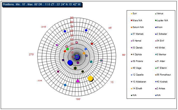
- Stars charts for all 59 stars giving SHA, elevation and bearing
- Star identification from angle and bearing
- Schedule of positions of all celestial bodies
- Sun and moon rise and set including sun transits
- Great circle navigation

The accompanying manual does not teach all aspects of astro navigation however it is particularly suited to students of navigation who wish to apply the methodology. For example, you can choose to select the calculation of hour angles and declination in three ways:
- Aries Corrections, or
- Polynomial Coefficients, or
- Almanac Data - Greenwich and Sidereal Hour Angles and Declination
The Systematic Navigation manual explains all the formulae with examples and follows the procedures outlined in The Nautical Almanac and DP330: NavPac and Compact Data 2021-2025.

